Study details a glance
Biostratigraphy
Review
New
Biostratigraphy
Analyses
Palaeoenvironments
& Facies
Provenance
12
Wells
Palaeocene Cretaceous
Key points
- Re-analysis of samples and re-interpretation of the released data from 12 wells enables recognition of a significantly enhanced resolution in biostratigraphic and sequence stratigraphic zonation, and identification of Sandstone Members
- Maps illustrate and correlate the potential for clastic development in the Voring Basin through the Paleocene to Santonian intervals
- Nearly 1500 biostratigraphy analyses; 517 palynology, 509 micropalaeontology and 467 nannopalaeontology
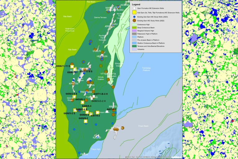
Upper Cretaceous sediments provide the main exploration targets in the deep water areas of Mid-Norway. Although the difficulties of seismic resolution and target definition, along with the associated costs, the recent discovery in the Stetind prospect continues to generate significant interest in the Vøring Basin. Recent licence applications for the 20th round are an indicator of the continued interest in the deep water area.
A number of sands are developed in the upper part of the Shetland and Rogaland Groups in Mid-Norway. These constituents of the Nise, Springar and Tang Formations in the Vøring Basin can be better constrained by a consistent and high-resolution stratigraphy.

This project aims to generate a robust stratigraphic model for the upper part of the Shetland and Rogaland Groups that can be applied to the understanding of potential reservoir development in the Cretaceous and early Tertiary of Mid-Norway.
- Detailed sampling of the drilled sections of wells with significant sands and shows will generate a high-resolution stratigraphic data set. This allows the cored sections to be placed in a stratigraphic framework that facilitates detailed mapping of the individual sands.
- Quantitative palynology and micropalaeontology, as well as nannopalaeontology, will be utilised to derive high-resolution stratigraphic and biofacies interpretations of the Campanian to Paleocene interval.
- New analyses will form the core of the data on which the interpretations will be based. These will be supplemented with re-examination of existing palynological slides where appropriate, to generate a significant new and consistent data set.
- Well selections are based on core coverage, geographical position, stratigraphic development (both clastic and argillaceous sections) and the presence of shows, as well as client feedback.
Aims
- deliver a high-resolution stratigraphic framework with documented supporting biostratigraphic events, for use in subsequent exploration and appraisal.
- generate a new and consistent stratigraphic data set for the Danian to Campanian intervals.
- correlate the sections using new paly, nanno and micro data.
- provide a better understanding of the timing of sand inputs.
- provide data on the reworking and sourcing of the sands.
- provide biofacies interpretations to improve the understanding of the palaeoenvironmental development.
Deliverables
- Approximately 520 new analyses for each discipline (paly, micro and nanno) focused on the cored and reservoir prone sections (approx. sample spacing 20m per discipline in drilled sections and approx every 2m in cored sections). Raw data delivered in StrataBugs format.
- Correlation panels showing chronostratigraphic and sequence stratigraphic interpretations.
- Project correlations and interpretations available in ODM format, allowing integration with corporate databases.
- Digital report formats (Adobe Acrobat). Hard copy reports available at cost.
Well List
| 6403/10-1 | 6607/5-2 | 6706/11-1 |
| 6404/11-1 | 6610/3-1 | 6706/6-1 |
| 6405/7-1 | 6610/3-1 R | 6707/10-1 |
| 6505/10-1 | 6704/12-1 | 6710/10-1 |