


Study details a glance

Reservoir
Quality

Palaeoenvironments & Facies

Depositional Systems

14
Wells

Jurassic
Key points
- Jurassic sands in these 14 wells all deeply buried, and in the ‘chlorite province’ of original studies.
- >770m core from 12 of the 14 wells described at a 1:200 scale, 140 core samples analysed petrographically, 120 core and cuttings samples analysed using QEMSCAN, 40 core samples with both XRD and SEM analysis.
- Seeking to refine depositional and diagenetic relationship between facies, provenance, chlorite content and reservoir properties.
Introduction
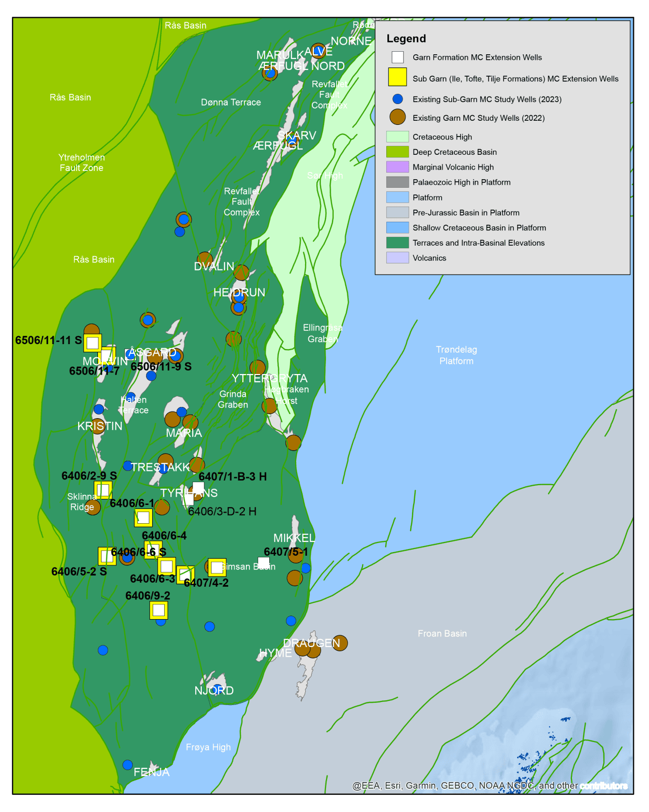
Coincident with the ‘chlorite province’ recognised in the original Garn (2022) and Sub-Garn (2023) regional reservoir quality studies, this new extension to both projects adds 14 wells to the west and southwest (close to the recent Mistral South discovery). Once again, a focus will be on documenting the occurrence and effect of grain-coating/pore-lining chlorite cements, that correlate to positive off-trend anomalies in the porosity/permeability reduction with depth relationship. Mineralogical composition collected via new petrography and QEMSCAN analyses, will be cross-referenced with a consistent facies interpretation from new core-descriptions, allowing us to test the relationships between diagenesis, facies and provenance across time slices. The well selection is dictated partly by present burial depth, with the top Garn Formation in the majority of these 14 wells buried to >4km (total depth range is ~3,400 – 5,200m). This includes a blend of discoveries, developments and dry wells in the Jurassic.
Key Deliverables
- 1:200 descriptions for >770m core from 12 of the 14 wells alongside CPI lith/porosity
- Analytical Program:
- Touchstone compatible petrographic descriptions of 140 thin sections (core)
- QEMSCAN analysis of 120 samples, to included chlorite typing of upto 20 selected samples (core and cuttings)
- SEM & XRD analyses upon 30 samples
- Integrated GIS summary maps for the J30, J40 & J50, J60, & J70-100 time slices (where recognised in these 14 wells) indicating facies & diagenetic relationships with depth & reservoir quality. PetroStrat to provide composite maps integrating datasets from the original Garn (2022), SubGarn (2023) and Garn & Sub-Garn Extension (2026), where companies have licensed all 3 multiclient studies.
- Core photographs illustrating sedimentological, ichnological & diagenetic features
- Facies-coded CCA database
14 wells included in this study
| 6406/2-9S | Ragnfrid Nord Prospect | 6406/9-2 | Onyx South West Appraisal |
| 6406/3-D-2-H | Tyrihans | 6407/1-B-3H | Tyrihans |
| 6406/5-2 S | Tott West | 6407/4-2 | Spinell Sør |
| 6406/6-1 | Eta Structure | 6407/5-1 | Adjacent to Trøndelag Platform |
| 6406/6-3 | Mjøsa | 6506/11-11 S | Iris Berling |
| 6406/6-4 S | Tvillingen Sør | 6506/11-7 | Morvin |
| 6406/6-6 S | Jasper | 6506/11-9 S | Cooper Prospect |
Explore Deliverables


